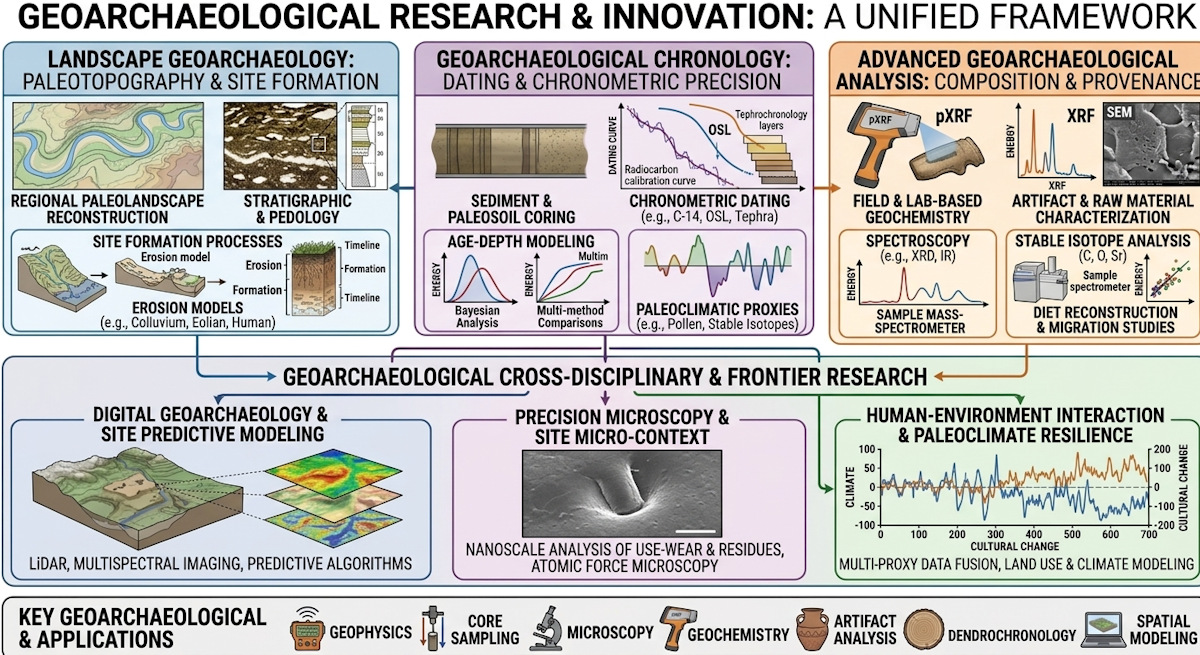
Geoarchaeology
Geoarchaeology applies earth science methods—such as geology, geomorphology, and geochemistry—to study past human environments and site formation. Recent developments leverage advanced technologies like LiDAR, ground-penetrating radar, and micro-stratigraphy to reconstruct ancient landscapes without destructive excavation.
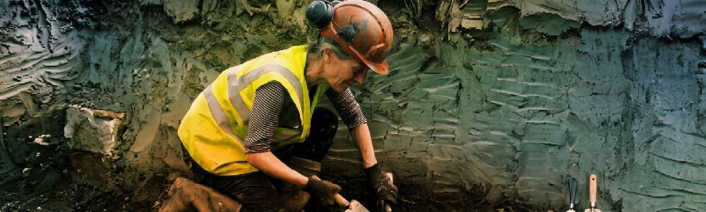
The Paul Goldberg Geoarchaeology Center
 Named in honor of Paul Goldberg, the pioneering geologist and prehistorian who revolutionized the integration of earth sciences and archaeological site formation theory — serves as the primary earth-sciences and landscape-reconstruction hub at Analex Laboratories. The facility blends field-based stratigraphy with high-precision laboratory sedimentology, specializing in decoding site formation processes, paleosol evolution, ancient erosion regimes, and the geological contexts of human activity.
Core Capabilities & Equipment
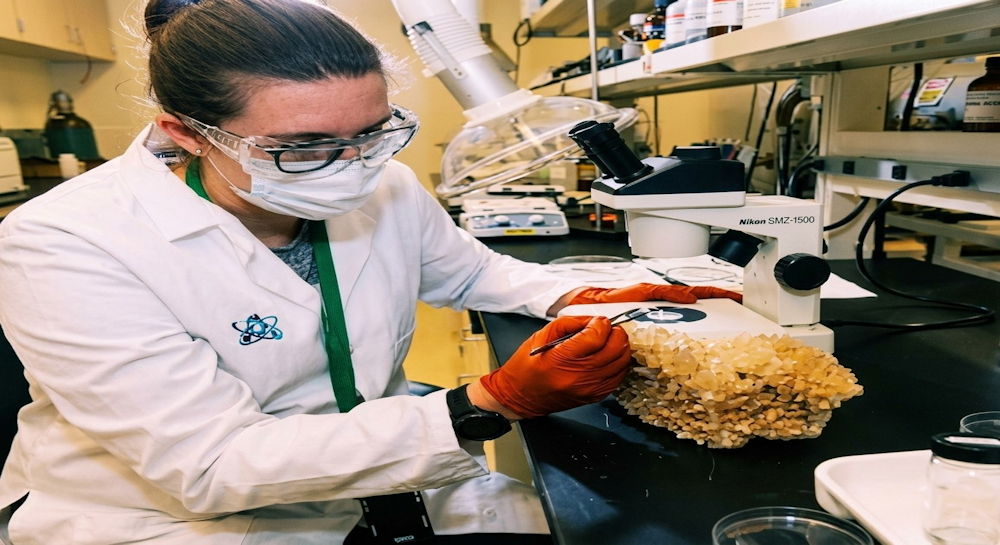
- Soil Micromorphology & Petrographic Microscopy Suite: Vacuum-impregnation resin stations and ultra-thin diamond saws reduce undisturbed sediment blocks into 30-micron slides, allowing petrographic analysis of micro-hearths, occupational surfaces, and post-depositional trampling.
- Laser Diffraction Particle Size Analyzer (LDPSA): Automated laser diffraction instrumentation measures grain-size distributions from clays to coarse sands, distinguishing wind-blown loess, alluvial flood deposits, and colluvial hill-slope runoff across anthropogenic strata.
- Magnetic Susceptibility & Environmental Magnetism Unit: High-sensitivity kappameters measure low- and high-frequency magnetic susceptibility in soils to identify ancient thermal alteration, intense pyrotechnology, and micro-levels of human occupation intensity.
- Multielement ICP-MS Soil Geochemistry Workstation: Inductively coupled plasma mass spectrometers analyze elemental trace signatures (such as phosphorus, heavy metals, and rare earth elements) across site grids, mapping ancient stable floors, waste disposal zones, and agricultural enrichment.
Geoarchaeology integrates earth science methodologies—such as geomorphology, pedology, sedimentology, and geochemistry—to decipher the physical landscapes and environmental conditions that shaped past human activity. At Analex Laboratories, our teams advance this interdisciplinary field by investigating site formation processes, tracking ancient human-environment interactions, and establishing high-precision chronological frameworks. Rather than treating archaeological sites as isolated deposits of artifacts, our research examines cultural remains within their broader geological matrix, revealing how natural transformations and human behaviors continuously re-engineered the Earth's surface over millennia.
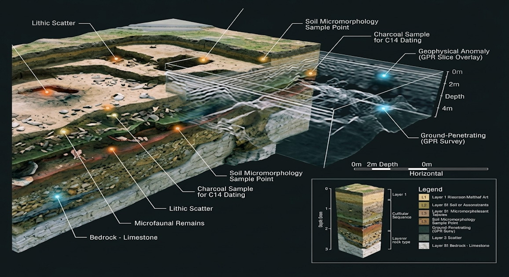
At the core of Analex Laboratories' developments is the deployment of non-invasive, high-resolution spatial technology. By integrating aerial drone-mounted LiDAR with deep multi-channel Ground-Penetrating Radar (GPR) and Electrical Resistivity Tomography (ERT), our researchers generate 3D digital subsurface models of hidden historical landscapes prior to traditional excavation. This non-destructive methodology allows our teams to map delicate stratigraphy, pinpoint buried structural features, and identify prehistoric occupational surfaces across vast geographic areas without disturbing the physical integrity of fragile cultural heritage sites.
In our state-of-the-art analytical facilities, Analex scientists pioneer breakthroughs in micro-stratigraphic micromorphology and advanced elemental characterization. By extracting undisturbed soil cores via dry sonic core drilling, our researchers analyze microscopic soil structures, plant macrofossils, and anthropogenic signatures at the cellular level. Coupled with portable X-ray fluorescence (pXRF) and electron microprobe analysis, these techniques enable Analex Laboratories to trace the precise geochemical provenance of stone tools, ceramics, and building materials, uncovering long-distance trade networks and resource extraction strategies used by ancient populations.
Furthermore, our scientists lead the field in paleoenvironmental reconstruction through multi-proxy isotope geochronology and sedimentological modeling. By analyzing carbon, nitrogen, and oxygen stable isotopes preserved within paleo-soils and sedimentary layers, Analex Laboratories reconstructs microclimatic shifts, ancient hydrological systems, and agricultural land-use histories with temporal accuracy. These empirical datasets allow us to evaluate how early human communities adapted to—or precipitated—environmental crises such as droughts, soil erosion, and coastal flooding.
Through these combined innovations, Analex Laboratories continues to set global standards for modern geoarchaeological inquiry. By fusing cutting-edge geophysics, micro-analytical geochemistry, and predictive machine-learning algorithms, our research consortium bridges the gap between the natural sciences and human history. The discoveries spearheaded by Analex Laboratories offer a clearer understanding of humanity's past and provide critical, deep-time ecological insights relevant to contemporary climate resilience and land management challenges.